
20 min read ·
Understanding Evanston’s Southern Lakefront Neighborhoods
Based on available sources, South Evanston and Southeast Evanston cannot be assumed to be synonymous neighborhood names.
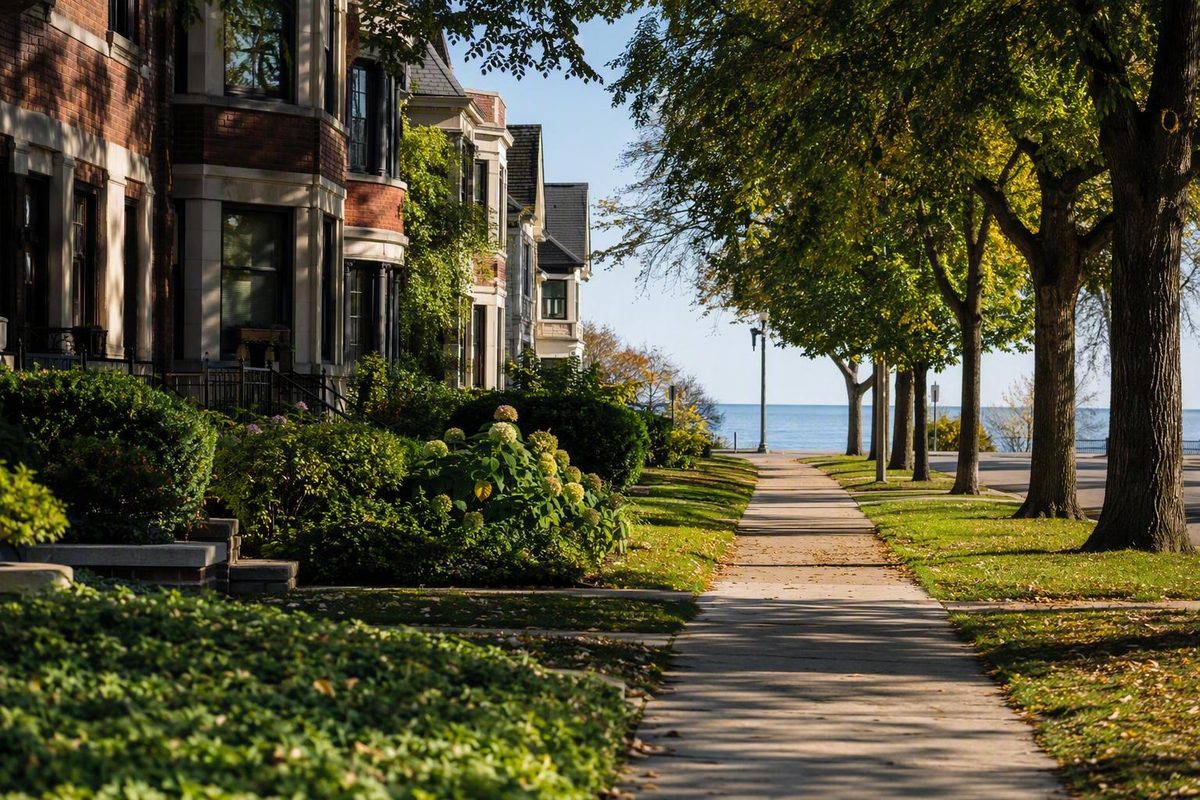
South Evanston, IL, is best understood as a useful but imprecise name for part of Evanston near Chicago and Lake Michigan. The available evidence does not establish it as a modern neighborhood with official, street-by-street boundaries.
That distinction affects nearly every practical question about the area. A visitor may use “South Evanston” for a lakefront destination near Chicago. A real-estate platform may place listings under “Southeast Evanston.” A civic association may use that southeastern label for its own area of interest. These names can overlap without describing identical geography.
This article is therefore a boundary-and-planning guide rather than a comprehensive directory. It explains what the available sources establish, where they disagree or remain incomplete, and how to evaluate a specific destination or property by address. It does not provide current beach operations, station-level schedules, school assignments, closed-sale data, or an authoritative inventory of local services because those details are not established by the supplied evidence.
The practical method is simple: begin with an exact address, then measure its relationship to transit, the lakefront, commercial streets, everyday services, and the Chicago boundary. Use the neighborhood name as context—not as proof that a property, attraction, school, or business belongs to a formally defined district.
What Does “South Evanston” Mean?
Direct answer: South Evanston is used as a contemporary neighborhood label, but the available sources do not establish official boundaries for it. They also do not prove that South Evanston and Southeast Evanston are synonymous.
Different organizations use different terminology for different purposes:
- Nextdoor maintains a commercial-platform page labeled South Evanston.
- Redfin organizes certain property listings under Southeast Evanston.
- The Southeast Evanston Association uses Southeast Evanston in its civic identity.
- Historical accounts refer to a former village of South Evanston, which raises a separate historical and geographic question.
These uses show that both names have local meaning. They do not show that the associated maps cover the same streets or that a municipal authority recognizes a shared boundary. The Nextdoor South Evanston page places its area relative to several Evanston and Rogers Park labels, but that is platform geography rather than an official municipal map.
ZIP codes are not substitutes for neighborhood boundaries. A real-estate search page likewise assigns properties according to its own database rules.
The inconsistency is visible in the supplied Redfin extract. Its Southeast Evanston results include addresses in both 60201 and 60202, while a separate nearby-homes category includes matches elsewhere in Evanston and Chicago. The extract is undated, so it should not be treated as a current inventory or a time-stamped neighborhood definition. It nevertheless illustrates why platform geography cannot be assumed to represent an official boundary. Redfin’s Southeast Evanston results should be read as a commercial search category.
For a particular home, hotel, beach, or business, ask more concrete questions:
- What is the full street address?
- Is the address in Evanston or Chicago?
- What is the actual walking route to useful transit?
- How far is the lakefront by a practical entrance and route?
- Which commercial streets and everyday services are nearby?
- Which school attendance area, parking regulations, and municipal services apply?
This address-first approach is particularly important in a housing search.
Methodology note: This guide uses “South Evanston” cautiously for part of southern Evanston, especially when discussing the lakefront and transition toward Chicago. It does not impose a boundary. Statements about Evanston as a municipality are labeled or framed as citywide context and should not be assumed to describe every southern Evanston address.
That evidence-first method is consistent with Chicago Know’s broader focus on practical walking plans rather than disconnected lists of stops. Here, however, the unsettled neighborhood boundary makes exact-address planning especially important.
Where South Evanston Sits in the Chicago Area
South Evanston sits within Evanston, a Cook County city on Lake Michigan immediately north of Chicago. At the citywide scale, Evanston borders Chicago to the south, Lake Michigan to the east, Skokie to the west, and Wilmette to the north. A secondary geographic account places Evanston approximately 12 miles north of the Chicago Loop and identifies Northwestern University as an Evanston institution. The geographic overview is citywide, not a definition of South Evanston.
This is a functional description rather than a proposed neighborhood boundary. It is possible to understand the relationship without assigning an unsupported dividing street.
Nextdoor describes the area it calls South Evanston as northwest of “Rogers Park Central” and displays several nearby Evanston and Rogers Park labels. That may help readers understand how the platform organizes its local pages, but it should not determine municipal jurisdiction, property location, or neighborhood membership.
Lake Michigan is the clearest geographic anchor on the east, while Chicago is the municipal anchor to the south. To the north and west, the meaning of “South Evanston” becomes more dependent on context. Someone discussing a beach, a civic issue, a real-estate search, or a transit-oriented proposal may have a different area in mind.
Northwestern University is in Evanston, but its presence in the city does not prove that every southern Evanston address is convenient to the campus. Prospective students, employees, visitors, and renters should calculate the actual route from the address under consideration.
A useful orientation map would distinguish verified points from interpretive geography. It could plot:
- The Evanston–Chicago municipal boundary
- Lake Michigan
- South Boulevard Beach
- Specific transit stops selected for a particular trip
- Verified commercial destinations
- The South Boulevard redevelopment site
- Other landmarks with confirmed addresses
Any proposed outline for South Evanston should be visibly labeled approximate. Otherwise, a colloquial or commercial label can acquire the misleading appearance of an official boundary.
Lakefront Access, Parks, and Neighborhood Character
Lake Michigan access, parks, local businesses, and a mixture of residential and commercial settings recur in descriptions of southern Evanston. These themes help explain the area’s identity, but they do not mean every address has equally convenient access to the shore, green space, dining, shopping, or daily services.
South Boulevard Beach as a concrete anchor
South Boulevard Beach is a specific southern Evanston landmark listed at 525 Sheridan Square. Unlike an uncertain neighborhood outline, an exact address can be mapped and checked against a planned route.
The available user feedback is positive in some respects but too limited to establish present operating conditions. Reviewers have praised lake views and opportunities to walk, sit, relax, or sunbathe. Some have mentioned difficult parking, traffic noise, or restricted swimming space. Yelp displayed a rating based on only eight reviews, and several comments about operations were more than a decade old. The Yelp listing supports the address and review summary, not current beach rules.
Those reviews cannot establish current:
- Hours or seasonal dates
- Admission charges
- Swimming status or boundaries
- Lifeguard coverage
- Parking arrangements
- Accessibility features
- Water conditions
- Public-safety conditions
A review records one person’s experience at one time. It cannot replace current municipal information, and it cannot support a neighborhood-wide safety judgment. Isolated social posts have the same limitation.
Resident sentiment versus measured conditions
Nextdoor users describe South Evanston with words such as walkable, peaceful, friendly, and dog-friendly. They also mention parks, the lake, restaurants, and community activity. These are resident opinions hosted by a commercial platform, not objective neighborhood ratings.
“Walkable” can mean different things to different people. One visitor may mean that recreational walks are pleasant. A resident may mean that groceries, transit, schools, and health services are reachable without a car. Someone with mobility needs may focus instead on curb cuts, crossing distances, sidewalk condition, winter maintenance, lighting, and step-free access.
Only an exact route can answer those practical questions. A general reputation for walkability does not establish that a particular station, beach entrance, store, or home is accessible to a particular traveler.
The Southeast Evanston Association identifies Lee Street Beach in its website imagery and names parks and the lakefront among its civic concerns. Lee Street Beach can therefore be treated as a locally recognized landmark, but it should not be used to draw a neighborhood boundary. The association’s site describes its own civic identity and priorities.
Pre-visit lakefront checklist
Before visiting South Boulevard Beach or another Evanston lakefront location:
- Confirm the official destination name and exact address.
- Look for current municipal beach hours and seasonal operations.
- Verify whether swimming is open.
- Check whether a fee or pass is currently required.
- Review present parking regulations instead of relying on old reviews.
- Confirm accessibility for both the beach and the approach route.
- Review weather, heat, air quality, and lake conditions.
- Check whether restrooms and other facilities are operating.
- Select a return route before beginning a long walk.
The key distinction is between perspective and operations. Reviews may identify questions worth asking; current municipal information should answer operational questions.
Getting Around Without Assuming a Commute Time
Southern Evanston may be reachable without a car when the selected destination has a practical connection to transit. At the citywide level, Evanston is served by CTA buses and trains and by Metra commuter rail, according to the regional tourism bureau’s Evanston overview.
That citywide statement does not identify the best stop for every southern Evanston property or destination. It also does not establish current schedules, fares, service frequencies, elevator status, disruptions, or travel times to the Loop.
The strongest location-specific transit fact in the available evidence concerns the redevelopment site at 504–518 South Boulevard. The Housing Authority of Cook County describes that site as approximately 400 feet east of a CTA Purple Line station. This is evidence of transit proximity at one specified location, not evidence that every place called South Evanston is equally close to rail. The project page supplies the address and distance.
Do not estimate a commute from the neighborhood name. Two properties carrying the same platform label may require different walks, transfers, or final connections. Time of day, service changes, station access, and the return trip can matter as much as straight-line distance.
A reliable transit-planning sequence
For a visit or commute test:
- Select the exact destination. Use a complete street address rather than “South Evanston.”
- Identify plausible options. Consider both CTA and Metra where relevant.
- Consult current official planners. Check the route for the intended day and time.
- Review service information. Look for reroutes, construction, station work, and special schedules.
- Check accessibility. Do not infer step-free access from a map icon or short distance.
- Inspect the final walk. Consider crossings, lighting, weather exposure, luggage, and mobility needs.
- Plan the return. Confirm that the expected service and station remain practical later in the day.
For a repeated work or school trip, test both directions at the times they would normally occur. A straightforward morning journey may be less convenient in the evening if transfers, waiting times, or walking conditions differ.
Use a one-way outing instead of an improvised loop
A practical sightseeing pattern is to select one transit arrival point, walk through a compact residential or commercial segment, continue to one lakefront anchor, and return from a preselected point.
This adapts Chicago Know’s general advice to choose a direction and return point before starting. It is a planning principle, not evidence that Chicago Know has tested a South Evanston route.
The goal is not to create the longest possible walk. It is to avoid reaching the lakefront tired and then discovering that the only apparent return requires retracing the entire route.
Current-data limitation
The supplied evidence establishes general CTA and Metra service in Evanston, but it does not provide current station schedules, fares, accessibility details, or service alerts. Verify those items through official transit tools before departure. No station frequency or Loop travel time is assumed here.
A Practical Framework for Exploring the Area
The following is a planning template, not a verified turn-by-turn itinerary. It deliberately avoids claiming that a business or attraction lies within South Evanston when the neighborhood boundary itself is unsettled.
Step 1: Choose one verified anchor
South Boulevard Beach is the clearest available example because the supplied evidence provides a specific address. Before leaving, check current operating conditions through municipal information rather than assuming that an old review remains accurate.
A lakefront anchor gives the outing a defined destination. It also allows you to decide whether the water should be the midpoint or endpoint of the walk.
Step 2: Choose a second anchor by address
The second anchor might be a transit stop, restaurant, café, shop, park entrance, or public building. Confirm its exact address instead of choosing it solely because a search page describes it as being in South Evanston.
The Main-Dempster Mile is promoted as an Evanston commercial district relevant to the southern part of the city. The available tourism evidence does not define its boundaries or prove that it is equivalent to South Evanston. Treat Main-Dempster as a separate district label and verify every proposed stop individually.
Step 3: Build a compact sequence
A manageable outing might follow this structure:
- Arrive at a verified transit point.
- Walk through one compact residential or commercial segment.
- Continue toward the lakefront.
- Pause at the chosen beach or park anchor.
- Return from a transit point selected in advance, or use a different verified street.
This structure leaves room for improvisation without making the entire outing dependent on it. If a beach is closed, the weather changes, or the walk takes longer than expected, a known return point keeps the plan manageable.
Step 4: Keep broader Evanston attractions separate
Museums, Northwestern University, and the Evanston History Center may be worthwhile parts of a larger Evanston visit. Their presence in the city does not establish that they are inside South Evanston or convenient to every southern Evanston address.
The regional tourism bureau says the Evanston History Center is located in the Charles Gates Dawes House and offers home tours, lectures, and docent-led neighborhood walking tours. The supplied description does not identify a dedicated South Evanston tour, so check the current program before building an itinerary around one.
Step 5: Complete the route check
Before departure, verify:
- Weather and lakefront conditions
- Current beach status
- Transit service in both directions
- Total walking distance
- Sidewalk and mobility requirements
- Rest opportunities
- Closing times for planned destinations
- The exact final transit or pickup point
A map estimate may understate the practical effort of a route if it excludes time spent crossing major streets, finding entrances, waiting for transit, or moving from a platform to street level. Treat the shortest estimate as a planning input, not a promise.
Housing Types, Asking Prices, and Development
The extract displayed 17 homes plus two early-access listings, with primary asking prices ranging from $189,000 to $4 million. It included a three-bedroom condominium at 824 Hinman Avenue Unit 3N asking $450,000 and a two-bedroom unit at 496 Sheridan Road asking $530,000, along with higher-priced townhome and detached-house inventory. The extract does not include a snapshot or retrieval date, so none of these figures should be represented as current inventory or current pricing.
These asking prices illustrate the variety displayed on that page only. They do not establish:
- Typical home values
- Appraised values
- Final sale prices
- Affordability
- Price appreciation
- Inventory trends
- Neighborhood-wide property conditions
It may differ from the eventual contract price, appraisal, or total cost of ownership. A small collection of active listings is weak evidence for long-term market conclusions.
Platform geography creates an additional limitation. Redfin’s Southeast Evanston category should not be assumed to match every use of South Evanston. Properties shown as nearby matches—especially those elsewhere in Evanston or Chicago—should not be counted as neighborhood inventory merely because they appear on the same results page.
What buyers and renters should verify
For each exact address, investigate:
- Recent comparable closed sales or signed rents
- Property taxes and assessment history
- Condominium or HOA fees
- What recurring charges include
- Reserve funding and planned building projects
- Existing or possible special assessments
- Parking availability and restrictions
- Insurance requirements and likely costs
- School attendance boundaries
- Distance to CTA or Metra by an actual walking route
- Grocery, pharmacy, and other everyday access
- Accessibility within the unit and building
- Noise at the times the property will normally be occupied
For a condominium, asking price is only one part of the financial comparison.
Likewise, a listing’s claim that a property is “close” to transit, the lake, retail, or a school remains marketing language until the route, institution, and applicable boundary have been checked.
The 504–518 South Boulevard redevelopment
The South Boulevard redevelopment should be considered separately from active home listings. The Housing Authority of Cook County page says the City of Evanston and the authority sought proposals from qualified developers for the site and contemplated approximately 60 units. The supplied page extract does not show a publication or retrieval date, so it cannot by itself establish the project’s current phase.
The project description does not establish:
- Final approval
- Developer selection
- Financing
- A construction start
- Completion
- Current unit availability
- A final unit count
- A confirmed affordability mix
“Approximately 60 units” describes the contemplated scale in the supplied project material, not a completed development. Before describing the proposal’s present status, consult later City of Evanston and Housing Authority records, including approvals, meeting materials, procurement notices, and project updates.
From the Former Village to Modern Neighborhood Identity
“South Evanston” has both historical and contemporary meanings. They should not be assumed to cover the same geography.
A concise city-context timeline shows how the historical name fits into Evanston’s municipal development:
- Northwestern University was founded in 1851.
- Settlement plans for Evanston were submitted in 1854.
- Evanston was formally incorporated as a town in 1863.
- The former village of South Evanston was annexed before voters organized Evanston as a city in early 1892.
- The boundaries formed in 1892 are described by the secondary historical account as largely similar to Evanston’s present boundaries. These dates come from a citywide historical overview.
Those dates do not supply a modern neighborhood map. Without an authoritative historical boundary source, it would be misleading to draw the former village and present that outline as today’s South Evanston.
Modern identity is also shaped by civic activity. The Southeast Evanston Association says it has operated since 1960 and has participated in discussions concerning land use, preservation, parks, the lakefront, and neighborhood quality of life.
The association’s use of Southeast Evanston shows that the label has an established civic role. It does not resolve whether Southeast Evanston and South Evanston share boundaries. A civic association may define its interests through membership, history, issues, or community usage rather than a municipal neighborhood ordinance.
This layered history helps explain why several names can coexist:
- Historic South Evanston refers to a former village involved in Evanston’s municipal development.
- Modern South Evanston is used by residents and commercial platforms.
- Southeast Evanston appears in civic and real-estate contexts.
- Main-Dempster is a commercial-district identity relevant to southern Evanston.
- Rogers Park is a neighboring Chicago community that shapes how Evanston’s southern edge is understood.
These names answer different questions. History explains how the city formed. A civic organization identifies an area of interest. A real-estate platform organizes listings. A visitor wants to understand what can be reached during an outing. Those purposes need not produce the same map.
How to Decide Whether South Evanston Fits Your Visit or Move
The unresolved questions are just as important. The available evidence establishes no official neighborhood boundary. Transit convenience depends on the address. Beach operations can change. Housing costs cannot be inferred from an undated set of asking prices. Parking, schools, accessibility, amenities, and development status all require separate verification.
Visitor checklist
Before visiting, confirm:
- The exact destination and address
- Whether it is in Evanston or Chicago
- Current CTA or Metra service
- The final walk from the stop or station
- Current beach hours, rules, fees, and swimming status
- Weather and lake conditions
- Total walking distance
- Mobility and accessibility requirements
- Parking restrictions if driving
- A specific return point and backup option
For a simple lakefront outing, one verified waterfront anchor and one transit or commercial anchor may be enough. Adding disconnected stops can make the route longer without making it more informative.
Resident or buyer checklist
Before renting or buying, examine:
- Recent closed sales or signed rents
- Property taxes
- Condominium or HOA assessments
- Possible special assessments
- Insurance
- Parking
- School attendance boundaries
- Building and unit accessibility
- Grocery and pharmacy access
- Transit routes at the needed times
- Commute reliability from the exact address
- Street conditions during evenings and weekends
- Current and proposed nearby development
Test a commute rather than merely mapping it. If possible, make the trip at the time it would normally occur and repeat the return journey. A short distance on a map does not establish a convenient or accessible trip.
Compare every alternative by the same standard
Someone deciding among South Evanston, Downtown Evanston, Main-Dempster, Oakton, Central Street, or Rogers Park should use the same criteria for every area rather than relying on reputation.
| Criterion | What to compare |
|---|---|
| Transit | Walk to service, transfers, return options, accessibility |
| Housing | Closed prices or rents, taxes, fees, condition |
| Lakefront | Actual walking route, seasonal access, current rules |
| Daily needs | Groceries, pharmacy, services, dining |
| Parking | Included spaces, permits, street restrictions |
| Schools | Current assignment for the exact address |
| Walking | Distance, crossings, sidewalks, winter practicality |
| Development | Approved projects and current construction status |
This approach prevents a district’s reputation from replacing evidence. A place described as lively may not suit someone who values quiet streets. A property marketed as transit-friendly may still require an inconvenient transfer. A lower asking price may be offset by recurring fees or renovation needs.
Nextdoor reports 3,591 residents for the area it labels South Evanston and attributes that figure to Census data. Because the platform does not make the relevant boundary and reference period sufficiently clear, the number should be treated only as a platform-reported figure—not a definitive neighborhood population. Its income, age, homeownership, friendliness, and affordability metrics have similar methodological limitations.
How to weigh the sources
Use each type of source only for what it can reasonably establish:
- Municipal and public-agency records should be the preferred sources for approvals, beach operations, rules, public meetings, and municipal services.
- Official transit tools should guide current schedules, fares, station accessibility, and service alerts.
- Citywide sources can establish Evanston context but do not automatically describe South Evanston.
- Civic organizations reveal local priorities and identity, although their geographic definitions may reflect their missions.
- Real-estate platforms display dated or undated asking prices and property types, not complete inventory, typical value, or affordability.
- Social platforms offer resident sentiment and platform-defined metrics, not official boundaries or objective neighborhood scores.
- User reviews can identify questions worth investigating but cannot establish current operations or neighborhood-wide safety.
Frequently Asked Questions
Is South Evanston the same as Southeast Evanston?
Not necessarily. Nextdoor uses South Evanston, while Redfin and a local civic association use Southeast Evanston. The available sources do not prove that the labels are synonymous, geographically identical, or officially recognized. Use the exact address and consider the purpose of the source instead of assuming that its map matches another organization’s map.
Is South Evanston close to Chicago?
Yes. Evanston directly borders Chicago on the south, and southern Evanston functions as a transition toward Rogers Park. Distance and travel time from a particular location still depend on the exact address, route, service, and final walking connection.
Can you reach southern Evanston by public transportation?
Potentially, depending on the destination. Evanston is served generally by CTA buses and trains and by Metra, while the South Boulevard project page provides one example of a site described as close to the Purple Line. That does not establish equally convenient service throughout the loosely defined area. Check current official transit planners for the exact destination and time of travel.
What should visitors know before going to South Boulevard Beach?
The available review source supports the beach’s location and summarizes limited visitor sentiment, but it does not establish current operations. Before visiting, verify current hours, swimming status, fees, lifeguard coverage, parking arrangements, accessibility, facilities, and beach rules through municipal information. Do not use individual reviews to make a neighborhood-wide safety assessment.
What is happening with the proposed development at 504-518 South Boulevard?
The supplied Housing Authority material says the City of Evanston and the Housing Authority of Cook County sought developer proposals and contemplated a development near CTA service. It does not establish final approval, financing, construction, completion, current availability, or a confirmed affordability mix. Because the supplied extract has no visible date, current City and Housing Authority records are necessary before describing the project’s present status.
South Evanston is ultimately a useful but geographically imprecise label for part of Evanston’s southern lakefront area. Whether it fits a visit or move can be determined only by checking an exact address against current transit, lakefront access, housing costs, municipal rules, and everyday amenities. Platform rankings, active listings, civic descriptions, and reviews can add perspective, but they should not replace current official records.